 Anou al Moris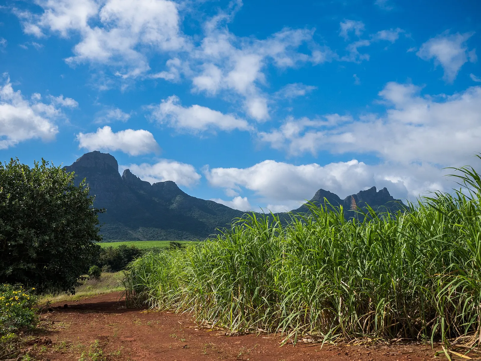
🚶 Walks · Tamarin / Yemen
Walk: cane fields and tracks of Yemen
Dirt tracks through the sugar cane between Magenta and the Yemen reserve, behind Tamarin, with the Trois Mamelles and the Rempart above you.
Behind Tamarin, the sugar estate of Yemen stretches up towards the mountains: a patchwork of cane fields, dry savannah and old stone walls crossed by dirt tracks. Walking (or cycling) here is the easiest way to see the 'inland' west coast: cane taller than you, mountains on every side, deer and monkeys at the edge of the reserve.
Much of it is private land, so go with a guide: DunienZîl, a family business based in Tamarin, runs guided walks and e-bike rides in Yemen (see the e-bike tour). Their family rides start near the Hindu shrine (kalimaye) at the Yemen/Magenta roundabout.
- Cane fields under the mountains
- Deer and monkeys at the edge of the reserve
- Fifteen minutes from the villa
Trail map
Approximate line on the estate tracks (Magenta Road): your guide chooses the route on the day.
Trail traced on OpenStreetMap paths: check the signs on the ground, and take the OSM or an offline map app (Organic Maps, maps.me) with you.
What to expect on this walk
- 📍 Where it starts
- Near the Yemen/Magenta roundabout, inland from Tamarin (15 minutes from the villa).
- 🧭 The route
- Wide dirt tracks between the cane fields, gently uphill towards the Yemen reserve, with views of the Trois Mamelles and the Rempart; back the same way (≈ 6–8 km in all).
- 🪨 Terrain
- Dirt and gravel tracks.
- 👁️ Views
- Mountains all around: the Trois Mamelles, the Rempart, the Tourelle.
- 🌅 Best light
- Early morning: cool air and deer at the edge of the fields.
- 🚧 Obstacles
- A private estate: go with a guide
- Harvest trucks on the tracks (June–December)
- 🏊 Swimming
- No swimming.
- 👟 Footwear
- Proper shoes with grip: rock, roots or mud (not flip-flops).
- 🔁 Getting back
- Same way back with your guide.
- 🦟 Insects
- Flies and some mosquitoes near the fields.
- 💧 Water
- None on the way: bring water.
- 👥 Crowds
- Very quiet.
- 📶 Phone signal
- Good coverage.
- 🎒 Bring
- Comfortable shoes · 1.5 litres of water each · Hat and sunscreen · Mosquito repellent · Snack
- Start near Magenta
- Towards the Yemen reserve
Getting there
🚗 By car: 15 min (8.4 km) off-peak. Near the Yemen/Magenta roundabout (your guide gives the exact meeting point). Directions in Google Maps ↗
- 🚲 Bike: close enough to cycle along the coast road (take care with traffic).
📅 Booking: Book with DunienZîl (WhatsApp +230 5828 8685).
Tips
- 💡 Private estate: don't wander in alone, and close any gates behind you.
- 💡 Harvest trucks use the tracks from June to December: keep to the side.